| Wow, quite a tough trek today. Many severe steep climbs, a few steep descents. Most of the terrain was very difficult trail, with big boulders littering the trail. At many points, the "trail" was a narrow trench worn into the rock, a foot or two deep. |
| Last night, I only got about four and a half hours of good sleep, followed by about the same amount of fitful snoozing. My bad leg (badly broken in July 2009 in a mountain biking accident) is aching, but not as bad as I expected it to. I took a naproxen first thing in the morning, just to counter the inevitable ankle swelling, and I carry a small bottle of same with me. |
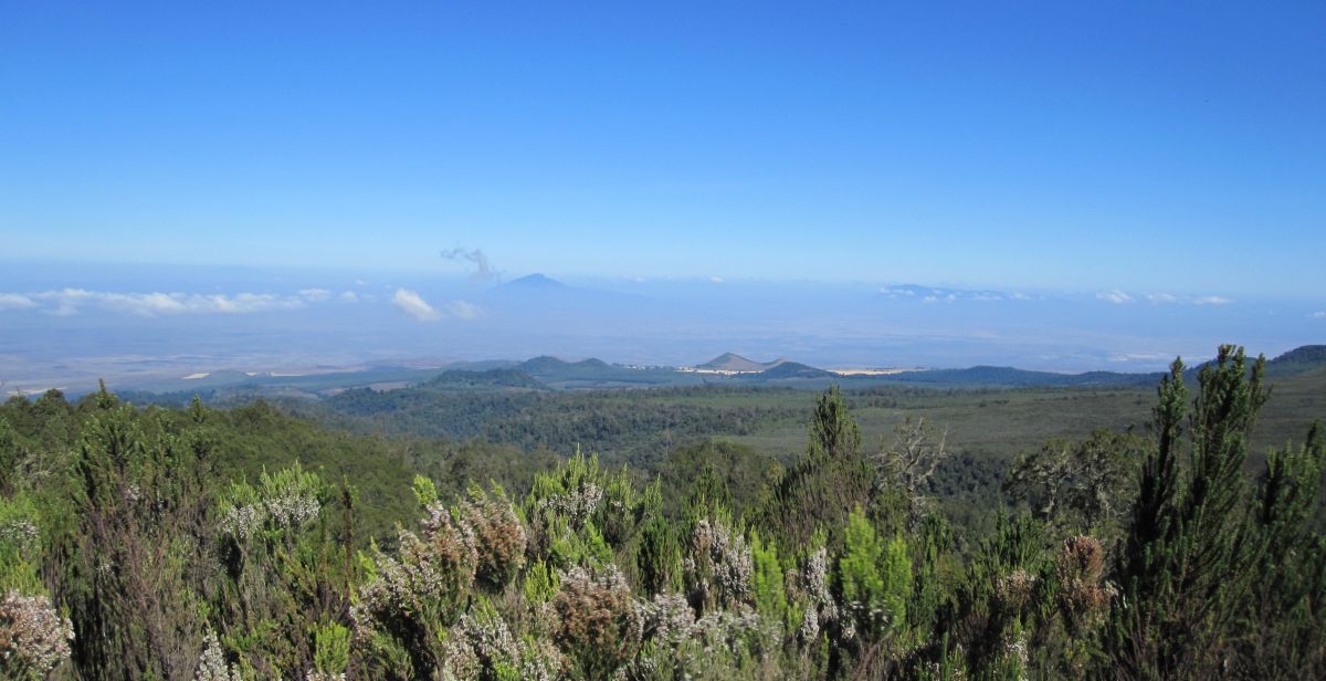
| We were out of the rain forest and into what, in the U.S., would be called "chapparal" in around an hour. The drawback to this was that we were exposed to harsh, high-altitude sun all day -- not a time to try to get a tan by skimping on sunscreen. On the plus side, there were spectacular views all around, including Mt. Meru (an active volcano) and some other mountains to the west, along with a few glimpses of Kibo past the Shira Ridge to the east. |
|
| Meru to the west, its top only
visible through the haze. |
| The porters had gone ahead (passing us frequently) to set up cooking gear and a lunch table for us, and after around four hours of hiking, we had a hearty meal of pasta, followed by mango slices and juice boxes. They have warned us to eat even when we have no appetite (as HAMS, or high-altitude mountain sickness, can suppress appetite), but so far that hasn't been a problem for me. |
| Two more hours of hiking, the last hour downhill, we arrived at Shira 1 camp. The Shira Plateau stretches out ahead of us with Shira Ridge and Shira Cathedral to our south and Kibo looming hugely to our east. I asked Simon about wildlife in that area, and he said it was possible we'd see jackals. Cool. |
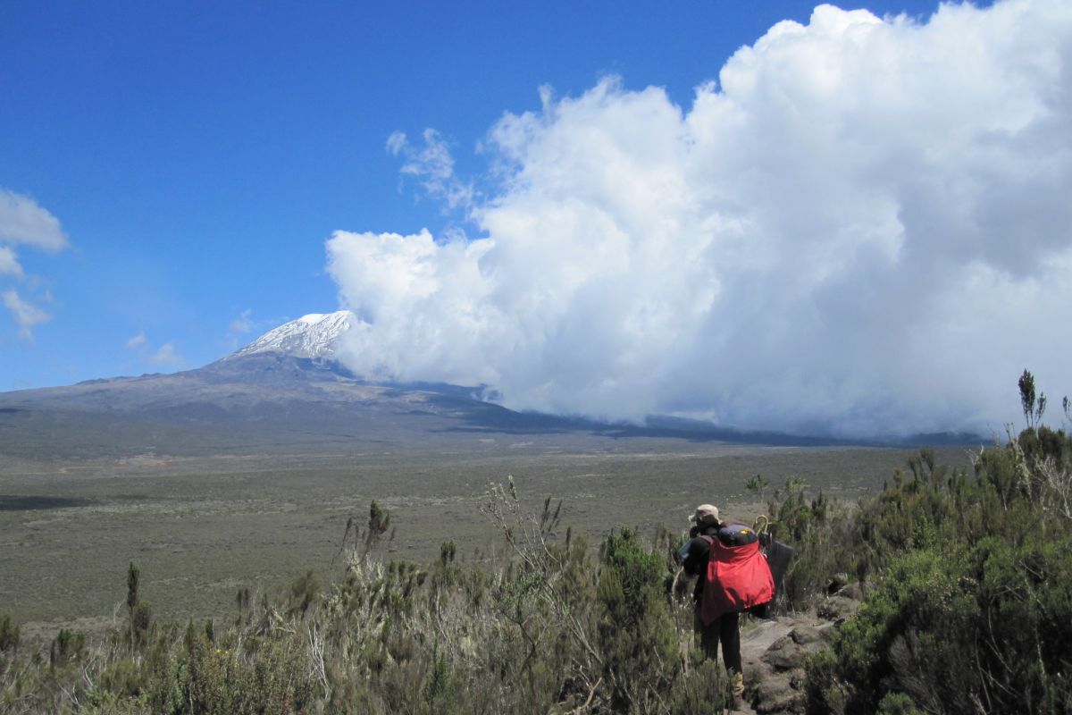 |
| Robert leads us downward to the Shira
Plateau, toward Shira 1 camp. Kibo visible in distance as clouds
roll in on the plateau. |
| It is noticeably colder on the plateau, and most of us throw on another layer. We are allowed to rest for an hour or so, then we embark on an optional "acclimitization hike." This is where we hike around 45 minutes up the ridge to gain 200-300 m of altitude, in order to acclimate to the altitude a little better. We sit up there for 10 minutes or so, then hike back down. We're all tired, but we all know it's a good idea, so everyone participates. |
| Another hearty, if kind of bland, meal for dinner. I can't complain about the food -- it's hot, filling, and there's plenty of it. And for the blandness, we have a bottle of chili sauce. |
| At dinner, Simon gave us two options for the Day 3 hike: |
|
| We unanimously agree to do #2. To be honest, I am a little skeptical of adding extra hiking time, given the difficulty of the trek ahead, but I'm not going to be the one to speak up against the idea. (Maybe everyone else was thinking the same thing, I don't know.) |
| It's getting quite cold now. I'm going to bundle up inside my sleeping bag. |
Stats for Day 2: |
|
|---|---|
| Starting elevation (Mti Mkubwa) |
9,498' (2,895 m) |
| Ending elevation (Shira 1 camp) | 11,500' (3,505 m) |
| Resting heart rate (evening) |
60 |
![]()