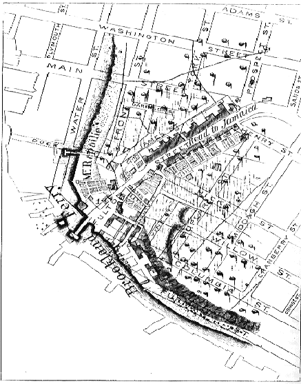
HISTORY OF BROOKLYN. 311 map
MAP OF BROOKLAND FERRY, IN 1766-7 AND 1867
REFERENCES TO MAP OF BROOKLAND FERRY, IN 1766-67 AND 1867.
THE, ancient portion (printed in black) of this map is from Ratzer’s (larger) “Map of New York and a part of Long Island”—drawn on a scale of 400 feet to tile inch—the years 1766 and ’67.
Over this, the street lines of the modern city (printed in red) have been drawn by Mr. Silas Ludlam, City Surveyor.
1. The “Corporation House,” or “Ferry Tavern,” known during the Revolutionary War as Messrs. Looseley and Elms’ “King’s Head Tavern.” (See page 311.)
2. John Rapalje’s house, with garden extending to the river.
3. The “Old Stone Tavern,” kept by Benjamin Smith.
4. Mr. Cary Ludlow’s house.
5. The Hicks mansion.
6. The Middagh mansion.
7. The Middagh barn.
8. The “Whalebone Gate,” so called from its being arched over with the rib-bones. of a whale. It opened, at the side of Mr. Thomas Everit’s house, into a lane leading tip to Mr. Cary Ludlow’s house.