Newtown Square Branch Trail: Baltimore Avenue former bridge
| < Previous | Up | Next > |
Not very many roads actually cross the right-of-way, but the roads that do cross it are major roads. The Newtown Square Branch was built in the 1890's; the minor suburban residential roads near the branch were obviously built later than the railway.
Almost all of the bridges on the Newtown Square Branch have been demolished. This poses a problem for a multiuse trail along the right-of-way. If the crossings are at grade, then it means that bicyclists and pedestrians will have to cross against heavy, fast-moving automobile traffic. On the other hand, replacing the demolished bridges would be expensive.
This Google Satellite Map shows the location of the now-demolished bridge over Baltimore Avenue.
Looking north where the bridge used to cross Baltimore Avenue.

Looking south across Baltimore Avenue. The bridge used to pass overhead, just to the left. Notice the pedestrian on the sidewalk just below the earthwork, for scale.
If this were made into an at-grade crossing, then the earthwork would have to be sloped much more gently. There could be flashing yellow lights warning and a zebra-stripe crossing warning fast-moving drivers.
If a new bridge were built, then there should be "exit ramps" sloping down on both sides of Baltimore Avenue, especially for folks going to do some shopping at the Giant.

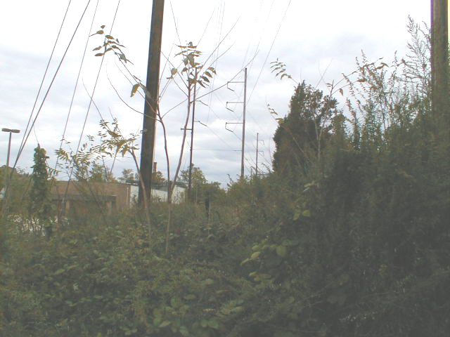
Standing up on the earthwork just north of Baltimore Avenue, looking northward up the overgrown right-of-way. The empty building formerly occupied by Super Fresh is visible to the left.
The Pembroke Avenue track yard
There used to be a switching yard at Pembroke Ave. It's worth taking a look at this Google Satellite Map.
Look at the quadrangle bounded by Union Avenue, Pembroke Avenue, Hirst Avenue, and Baltimore Avenue. You can see where a spur came off of the Newtown line. The spur runs northeast/southwest, and is now marked by a band of trees. You can see the old railroad grade in the thicket if you ride your bike up close.
The Lansdowne Post Office is at 9 o'clock in the quadrangle. According to one of the clerks at the post office, the building used to be Stroehman's Bread factory. The factory clearly once took delivery of supplies by rail.
The 7.5 minute US Geological Survey topographic maps still show the sidings of the old Pembroke Avenue track yard. I ought to scan it and include it here.
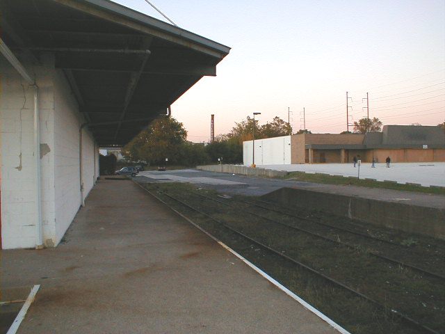
The view from one of the loading docks of the warehouse at Union Avenue and Baltimore Avenue. The spur used to come off of the main track (under the power lines in the distance to the right). It angled over in the area grown over by trees in the distance at center. It passed the Lansdowne Post Office, not visible behind the warehouse. The rails seen here are visible to traffic on Baltimore Avenue.
A warehouse obviously used to stand beside the loading dock to the right. It's hard to say how many other buildings and sidings might have been removed when the Super Fresh (now closed) was built.
| < Previous | Up | Next > |