Newtown Square Branch Trail: West Chester Pike
| < Previous | Up | Next > |
We now reach the intersection of West Chester Pike (Route 3), Township Line Road (Route 1), and Lansdowne Avenue/Darby Road (this road changes name as it crosses Township Line Road).
The track crossed diagonally right smack across the intersection of Lansdowne Avenue and Township Line Road (it's hard to imagine that this busy intersection used to be completely shut down when a train went thru). Then the track passed beside what is now the parking lot for Kohl's (the large building near the middle of the Google map); you can see the row of dark trees where the track ran northwest, forming a little triangle with Darby Road and West Chester Pike. Then the track crossed West Chester Pike just west of Darby Road and continued northwest into what is now a residential neighborhood.
This intersection poses one of the biggest problems for the multiuse trail; I haven't figured out a solution. These are very busy highways, making an at-grade crossing dangerous. There is no room for a bike lane to be added up Darby Road, and to bike in traffic would be a completely unacceptable solution. The sidewalk along Darby Road is very narrow and goes up some steps.
Even if overpass bridges were built, I think they would have to be very long, and I don't see exactly where they'd need to go.
There is also a major encroachment in the right-of-way immediately north of West Chester Pike which is also very problematic. Most of the encroachments along the right-of-way are minor, such as parking spaces, but putting the trail exactly where the train track used to run would be very problematic in the case of this particular encroachment.
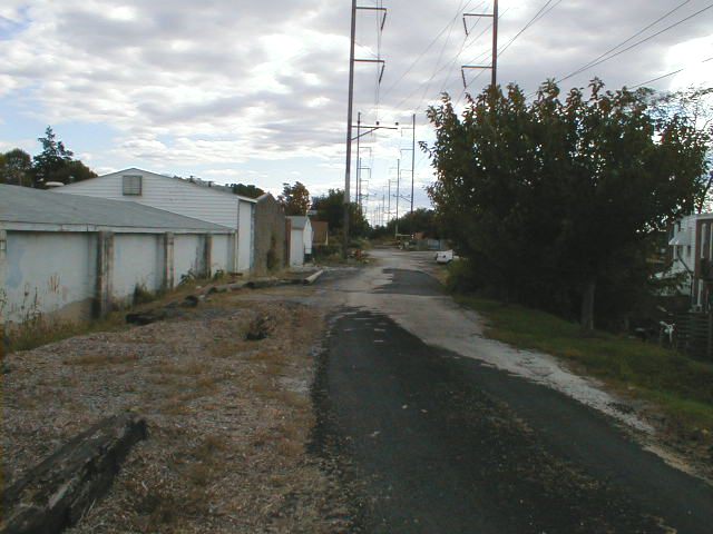
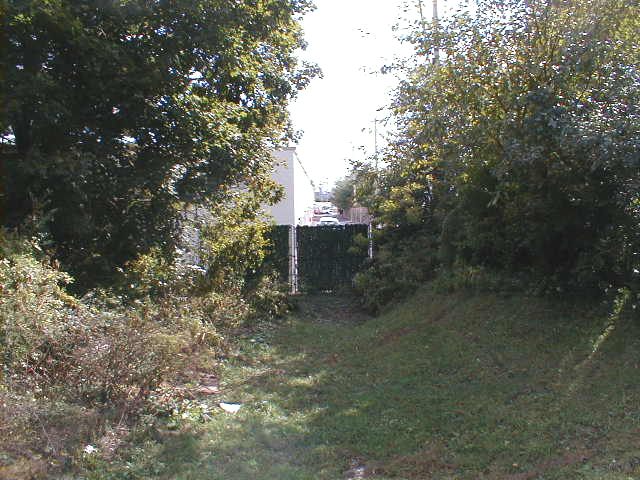
Approaching Township Line Road. After we get northwest of Delaware Avenue, the right-of-way is being used by one of more local businesses as an access road.
Looking south across the intersection of Lansdowne Avenue and Township Line Road. The train track used to go diagonally right smack across the middle of this intersection.
You can see the trackbed's hallmark power lines leading off to the south on the other side of the intersection. This intersection marks the northern end of those major power lines; they end at a power station in the southwest corner of the intersection. North of West Chester Pike, there is a much smaller power line on wooden poles along the right-of-way which can't be seen from a distance as the southern steel-girder towers can.
Notice how dreadfully busy the intersection is, and how there is no room for bicycles in the roadway.

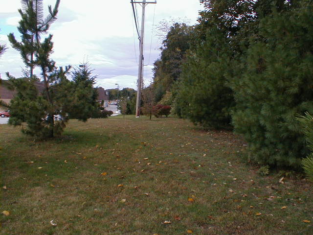
Standing on the old trackbed just north of Township Line Road. The wooden power lines follow the right-of-way. Kohl's department store is barely visible to the left thru the small tree.
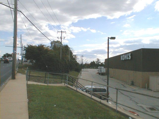
On West Chester Pike, just barely west of the intersection with Darby Road. We're looking southeast here. The track used to run up on the tree-covered just left of Kohl's; the power lines help make it clearer where the track ran.
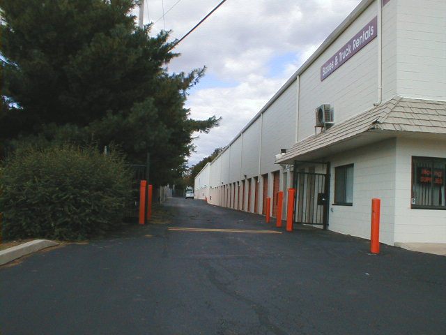
On the north side of West Chester Pike, facing northwest. The long building to the right is a moving/storage business. It's no longer obvious at all without studying a map, but the track used to run right where this fenced-in driveway now runs to give access to the storage units.
I don't see any obvious solution which runs the multi-use train anywhere near the original trackbed, short of running a very long steel-and-concrete bridge above the highways and over the storage business ($$$).
A little further north. We're at the far end of the storage business, which is on the other side of the fence. The earth cut in the foreground makes it a lot more obvious that there used to be a trackbed here.
| < Previous | Up | Next > |