Michael Shopsin's Software
Software / Old Software / About Me / Resume
This software is mostly of historical interest since it requires a PPC Mac or Rosetta to run so it doesn't work under Lion. Unfortunately MapProjector and ColorBarTender were written in Pascal using Metrowerks CodeWarrior so they cannot easily be updated. However I've left this page up in case the software is still useful to someone.
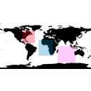
Special Regions 1.0
Copyright 2005
About:
Special Regions 1.0 allows you to change what locations extra information is collected by the GISS global climate model (GCM). The interface allows you to selection locations on a map of the Earth for different time periods.
Requirements:
Downloads:
Credits:

FileInfo v. 1.3
Copyright 2002-2004
About:
FileInfo changes the creator, type, and attributes of files or folders. Just drag files or folders to FileInfo to change them. Add your favorite applications to the default creator and type lists.
FileInfo 1.3 displays the icon of the file's default application. You can also drag files to the creator or type text field to insert their creator or type.
Requirements:
Downloads:
For MacOS X 10.1.5 users only:
Credits:
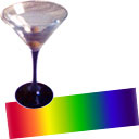
ColorBarTender v. 2.1
Copyright 1995-2003
About:
ColorBarTender modifies the palettes (color tables) used by AppleWorks in draw and paint mode. You can also create and edit scientific color tables similar to those used on the weather channel. ColorBarTender supports the color table formats used by many popular programs including: PAL, HDF, and AppleWorks Palette. AppleWorks®, IDL®, Transform, NOeSYS®, and Panoply have been tested with color tables created in ColorBarTender.
See the online manual for more information about ColorBarTender.
Requirements:
Downloads:
Credits:
![]()
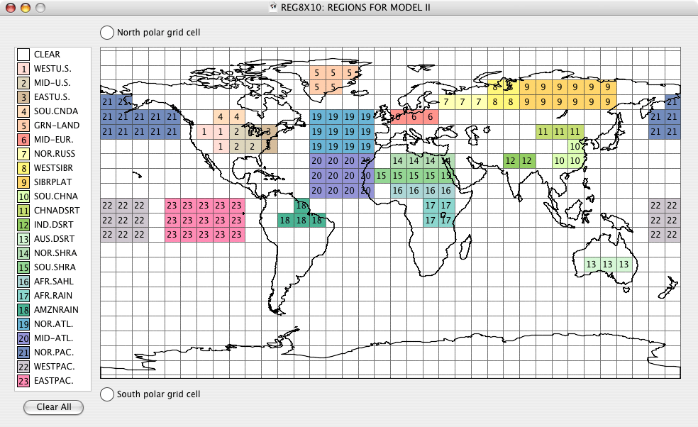
MapProjector v. 4.0.4
Copyright 1995-2005
About:
MapProjector 4.0.4 is a graphics program that can be used to view, alter and process images of global maps. Some of the primary functions of the program include the ability to recenter images, extract specific regions, and convert images to different projections (mollweide, orthographic, stereographic). Functions are also available to annotate images with features such as scalebars, latitude and longitude grid lines and continental overlays. Global maps are assumed to be rectilinear when they are first read in and users are asked to assign the latitude and longitude coordinates of their map when opening the image for the first time. The map coordinates are subsequently embedded within the image file after they are saved in MapProjector’s native format.
The new 4.0.4 version uses much less processor time under MacOS X and does font smoothing under MacOS X 10.1.5 & 10.2.
4.0.5 is not a public release since it has some hacks specific to other software. 4.0.4 and 4.0.5 work under MacOS X 10.3.
See the online manual for more information about MapProjector.
Requirements:
Downloads:
Credits:
Contact Information:
Last updated 08/23/13